
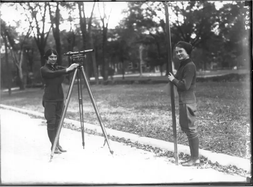
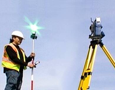
LAND SURVEY TERMS
GLOSSARY OF U.S. BUREAU OF LAND MANAGEMENT SURVEYING AND MAPPING TERMS – D
Land Survey Terms, A convenient source for our clients and website visitors
D
DEP. – Departure (of a traverse)
DI-10 – A brand name of electronic distance measurement equipment.
DATUM – A position or element in relation to which others are determined; a reference system. In surveying, two
principal types of datums are used – horizontal and vertical. See SEA LEVEL DATUM, NORTH AMERICAN DATUM OF 1927, 1927 NAD, HORIZONTAL GEODETIC DATUM and VERTICAL GEODETIC DATUM.
DATUM PLANE – A surface used as a reference from which to reckon heights or depths. The datum in most general use is based upon mean sea level and this is used as the reference for the first-order level net extending
over the whole country.
DATUM SHIFT – A graphical correction is required where source map data is on a different datum than the map
under revision.
DECIBEL- (GPS)- Most GPS antennas have a gain of about 3 dB. The decibel is a comparison value and not a unit of power.
DECISION – (PLSS)- a decision is the reduction to writing of the adjudicative process. A decision orders the disposition of a case in a certain way, and contains a statement of the facts, laws and reasoning which require that disposition.
DECLINATION – (SURVEY)- An angle of difference.
DECLINATION, ASTRONOMIC – (SURVEY)- The angular distance of a celestial body north or south of the celestial equator. Astronomic declination on the celestial sphere corresponds with latitude on the earth. It is noted as positive (+) when north and negative (-) when south of the celestial equator.
DEED – (SURVEY)- A document which transfers title to real property. In those instances where a complicated metes and bounds description is the only description available, a deed may be used to transfer fee simple interest in public lands.
DEFENDANT – (LEGAL)- The person defending or denying; the party against whom relief or recovery is sought in an action or suit.
 DEFICIENCY – (SURVEY)- The amount by which a boundary is less than the nominal amount.
DEFLECTION ANGLE (USGS) – The angle, measured in the vertical plane containing the flight direction,
between the datum of a model in a stereo triangulated strip and the datum of the preceding model. See
DEFLECTION ANGLE*.
DELINEATION – The visual selection and distinguishing of map-worthy features on the surface of various possible
source materials by outlining the features on the source material, or on a map manuscript (as when operating a
stereoscopic plotting instrument); also, a preliminary step in the compilation. See COMPILATION and PHOTO
DELINEATION.
DELTA – The fan-shaped alluvial tract formed at the mouth of a river, when it deposits more solid material there
than can be removed by tidal or other currents.
DENSITOMETER – Device used to measure the average grey-tone density of images on a piece of film. The
measurement may be a meter reading or an electronic signal. When the observed area is smaller than a few
hundred microns, the instrument is called a microdensitometer.
DENSITY – 1) The comparative amount of silver (or dye) in a given area of a photograph resulting from exposure
to light and development. 2) Descriptive of the number of survey control points in an area.
DEPARTURE – The east-west component of a traverse course.
DEPRESSION ANGLE – The vertical angle measured at the perspective center between the true horizon and the
photograph perpendicular. The complement of an angle of tilt.
DEPRESSION CONTOUR – A contour forming a closed loop around the lower ground.
DEPTH CURVE – A line connecting points of equal depth, referenced to a water surface. Intervals between depth
curves may be variable.
DEPTH OF FIELD – The range of object distance (lens to object) within which images formed by a lens, on a
given surface, have acceptable sharpness.
DEPTH OF FOCUS – The range of image distances (lens to object) within which the images formed by a lens, on a
given surface, have acceptable sharpness. In photogrammetry, it defines the range through which the projection
distance of a photogrammetric projector can be varied while preserving satisfactory image detail in the
stereoscopic model.
DESCRIPTION – The formally published data describing each triangulation, trilateration, traverse station, benchmark, or other mark preserving the horizontal position and/or elevation. The description contains information regarding location, type of mark, and augmenting data which will help find the mark and identify it.
DESERT – An almost barren tract of land in which the precipitation is so scanty or so sporadic that it will not
adequately support vegetation.
DETAILS – The small items or particulars of the information are shown on a map with bylines, symbols, and letting. The
greater the omission of details the more generalized the map.
DIAPHRAGM – The device for controlling the size of the opening of a lens. The size of the lens opening governs
the amount of light reaching the film.
DIAPOSITIVE – A positive photographic print on a transparent medium, generally glass, for use in a plotting
instrument.
![]() Please feel free to contact us about Land Survey Terms or any other questions. We are here now and ready to answer.
Please feel free to contact us about Land Survey Terms or any other questions. We are here now and ready to answer.
Phone Email us
DIAPOSITIVE CENTERING DEVICE – (USGS) A special device used to position the principal point of a
diapositive with respect to the placeholder.
DIAPOSITIVE – A device for making positive copies of negatives in the proper format for photogrammetry.
DICHROMATE PROCESS – A photographic rub-on color process used to transfer from one drawing to another.
DIFFERENTIAL LEVELING – The process of measuring distances in elevation by spirit leveling.
DIFFERENTIAL SHRINKAGE – The difference in unit contraction along with the grain structure of the material as
compared to the unit contraction across the grain structure; is frequently applied to photographic film and papers
and to mapping papers in general.
DIGITAL IMAGE (OR DIGITIZED IMAGE) – An image composed of small, uniformly shaped regions each of
which has assigned coordinates and a grey tone. See RESOLUTION CELL.
DIGITAL MAPPING – The process of generating a map using computer-processed data in numerical form.
DIGITIZING – The conversion of a space relationship or measurement to numerical values in which mapping or
cross-section data is converted to punch card form by a transducer and digitizer coupled to a recording system.
DIP ANGLE – The vertical angle of the observation point between the plane of the true horizon and a sightline to
the apparent horizon. In photogrammetry, this angle is measured in the principal plane of the photograph at the
exposure station.
DIRECT ANGLE – An angle measured directly between two lines, as distinguished in transit traverse from a
deflection angle.
DIRECT COPY – See AUTOPOSITIVE.
DIRECT MEASUREMENT – Determination of a distance by physical comparison or accumulation of distance
using a device calibrated in some unit of measure. See INDIRECT MEASUREMENT.
 DIRECTION – The angle between a line and an arbitrarily chosen reference line. When the reference line is north
or south and the angle is measured east or west, the direction is called a bearing. When the reference line is south
and the angle is clockwise, the direction is called an azimuth.
DIRECTION THEODOLITE – An instrument that has a horizontal circle that remains in one position
during one set of observations.
DIRECT POSITIVE – A film. See AUTOPOSITIVE.
DIRECT RADIAL PLOT – See RADIAL TRIANGULATION.
DIRECT RADIAL TRIANGULATION – See RADIAL TRIANGULATION.
DIRECT TIE – See DIRECT TIE*.
DISCREPANCY – The difference between two results of measurement or computation.
DISPLACEMENT – 1) Any shift in image position which does not affect the perspective characteristics of the
photograph. 2) Horizontal shift of plotted position of a topographic feature caused by adherence to prescribed
line weights and symbol sizes. See TILT DISPLACEMENT and RELIEF DISPLACEMENT.
DISSECTED PLATEAU – A Plateau into which a number of valleys have been carved by erosion; its origin as a
the plateau is patent, however, when the tops of the mountains and ridges are seen to be level against the skyline, it
shows that they once formed part of a continuous surface.
DISTANCE ANGLE – The angle in a triangle under a law-of-sines computation that is opposite the known
distance.
DISTORTION – Any shift in the position of an image on a photograph that alters the perspective characteristics
of the photograph. Causes of image distortion include lens aberration, differential shrinkage of film or paper, and
motion of the film or camera. See FILM DISTORTION and LENS DISTORTION.
DISTORTION CURVE – A curve representing the distortion characteristics of a lens; it is plotted with image
radial distances from the lens axis as abscissas and image radial displacements as ordinates. Image displacements
away from the lens axis are considered positive.
DIURNAL – Having a period of, or occurring in, or related to, a day.
DIVIDE – A ridge or area of elevated land between two basins or valleys.
DIVIDED HIGHWAY – A highway with separated roadways for traffic in opposite directions.
DODGING – The process of holding back light from certain areas of sensitized material to avoid overexposure of
these areas.
DOMESTIC MAP – A mapped area of the U.S.A.
DOPPLER EFFECT (Also DOPPLER SHIFT) – Apparent change in frequency of radiant energy (sound waves,
or electrical waves) when the distance between the source and the observer or receiver is constantly changing.
DOT GRAVER – A device for drilling a small circular hole for scribing maps.
DOT GRID – Film positive with regularly spaced dots used as an overlay over a photo or map in determining areas.
DOUBLE CENTERING – A method of prolonging a line from a fixed point whereby the backsight is taken with
the telescope in the direct position. The telescope is placed in the indirect position and foresight is made. The
point at which the vertical cross-hair intersects the hub is then marked. The transit is then rotated 180° to take a
backsight with the telescope in the indirect position, and a second projected point with the telescope in the direct
position is marked on the hub. A point midway between the two marked points is the true point on the prolonged
line.
DOUBLE-RODDED LINE – A line of leveling wherein two sets of turning points are used to give independent sets
of measurements from the same instrument setups.
DRAFTING GUIDE – See COLOR-SEPARATION GUIDE.
DRAINAGE – All map features are associated with water runoff.
DRAINAGE AREA – The area of a drainage basin.
DRIFT – 1) The horizontal displacement of an aircraft, caused by the force of the wind, from the track it would have
followed in still air. 2) A special condition of crab wherein the photographer has continued to make exposures
oriented to the predetermined line of flight while the airplane has drifted from that line.
DUMPY LEVEL – A leveling instrument with its telescope permanently attached to the vertical spindle or leveling
base as a single unit.
DUNE – A hill or ridge of sand formed by transportation by the wind.
DUPLICATING FILM – Sensitized emulsion on a transparent base manufactured for the special purpose of
duplicating photographs, particularly color photographs.
![]() Please feel free to contact us about Land Survey Terms or any other questions. We are here now and ready to answer.
Please feel free to contact us about Land Survey Terms or any other questions. We are here now and ready to answer.
Phone Email us