Introduction
Land development is a complex and multifaceted process that involves transforming raw parcels of land into functional spaces for residential, commercial, or industrial use. One crucial step in this process is the lot stakeout survey, a procedure that ensures the accurate delineation of property boundaries and the positioning of infrastructure, buildings, and other amenities.
Lot stakeout surveys play a pivotal role in minimizing property disputes, enhancing construction efficiency, and promoting sustainable land development.
This essay explores the significance of lot stakeout surveys, their methodologies, and their contribution to the successful realization of development projects.

Understanding Lot Stakeout Surveys
A lot stakeout survey, often referred to as a boundary survey or a property survey, is a comprehensive measurement and mapping process that identifies and demarcates the physical boundaries of a parcel of land. These surveys are instrumental in establishing legal property boundaries and preventing disputes between neighboring landowners.
The primary objectives of lot stakeout surveys include:
- Boundary Identification: The survey accurately determines the boundaries of a property, including corners and markers. This prevents encroachments and boundary disputes, ensuring that each landowner’s rights are protected.
- Land Subdivision: Lot stakeout surveys are critical when dividing a large tract of land into smaller lots for development. The surveyor ensures that each subdivided lot adheres to local zoning regulations and maintains compliance with land use plans.
- Infrastructure and Construction Placement: Accurate lot stakeout surveys are essential for positioning infrastructure elements, such as roads, utilities, and drainage systems. They also guide the placement of buildings, ensuring they are within legal setbacks and adhere to zoning codes.
- Easement Identification: Lot stakeout surveys identify any easements, which are legal rights of way or usage that affect a property. Understanding easements is crucial for landowners and developers, as they can impact the development process.
Methodologies in Lot Stakeout Surveys
To achieve the goals of a lot stakeout survey, surveyors employ a variety of methodologies and tools. These include:
- Property Deeds and Records: Surveyors start by reviewing property deeds, plats, and other legal documents to gain an understanding of the property’s history, dimensions, and any encumbrances.
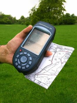
- Field Measurements: Surveyors use advanced instruments like total stations, GPS receivers, and laser rangefinders to measure distances, angles, and elevations accurately. These measurements are essential for mapping property boundaries and physical features.
- Boundary Markers: Surveyors often place or locate boundary markers, such as iron pins or concrete monuments, at key points along property lines. These markers serve as physical reference points for property boundaries.
- GPS Technology: Global Positioning System (GPS) technology has revolutionized lot stakeout surveys, allowing for highly precise positioning and mapping. GPS receivers can provide centimeter-level accuracy, making them invaluable in large-scale development projects.
- GIS (Geographic Information Systems): GIS technology is frequently used to integrate survey data into a digital format. This enables surveyors and stakeholders to access, analyze, and manage spatial information efficiently.
