An image of a Spanish American Woman Conducting a Boundary Survey, she is standing in front of 2 large backhoes it looks to be dusk with a multi colored sky of red, yellow, blue and white, she is wearing a white t-shirt and green cargo pants.

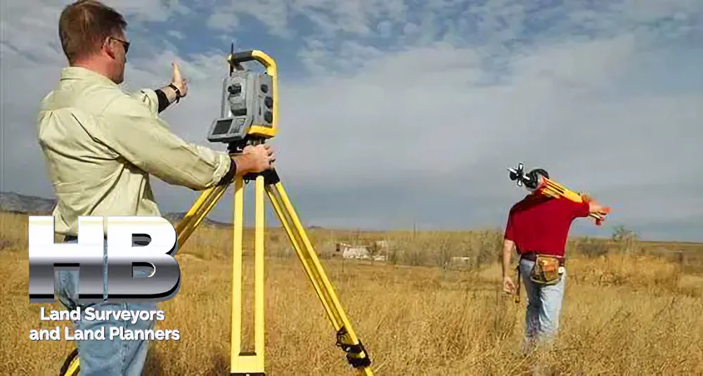
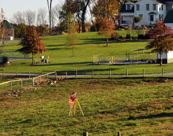
Since 1985 Boundary Surveys By Haller, Blanchard, and Associates Frederick, MD.


Survey Types

It is our intention to provide in-depth descriptions of the Land Survey and Land Planning Survey Types Provided by Haller, Blanchard, and Associates.


Those Survey Types will include but are not limited to, Land Surveys, Property Surveys, Boundary Surveys, ALTA Surveys, Topographic Surveys, As-Built Surveys, Site Surveys, Plat of Surveys, Residential Surveys, House Surveys, Staked Surveys, and more.


And a bit more…

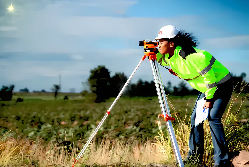
Land surveying is the process of measuring and mapping land and other features of the earth’s surface. It is an essential tool for various purposes such as property disputes, construction, urban planning, and resource management.

There are different types of land surveying methods, each with its unique characteristics and applications. In this category, we will go through some of the most common land survey types.
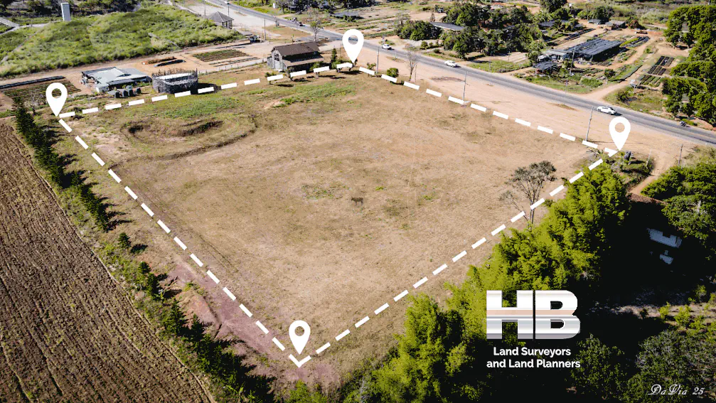
Boundary Surveys:
Boundary surveys are among the most common types of land surveying, and their purpose is to establish property lines and boundaries.

These surveys involve measuring and mapping the property’s corners and lines, which are then used to determine the exact size and shape of the property.

Boundary surveys are often required when purchasing or selling land, settling property disputes, and obtaining building permits.

Topographic Surveys:
Topographic surveys are used to map the natural and man-made features of the land, including hills, valleys, streams, roads, and buildings.

These surveys help to determine the land’s suitability for construction and development, and they provide valuable information for urban planning, resource management, and environmental assessments.

Topographic surveys are also used to create maps and models that show the land’s contours, elevations, and other physical features.

Construction Surveys:
Construction surveys are used to prepare for and monitor the progress of construction projects.

These surveys involve measuring and marking the land’s boundaries, setting out the site’s grades and elevations, and determining the location of structures and other features.

Construction surveys ensure that the building is constructed according to the design plans and that it complies with local building codes and regulations.

Geodetic Surveys:
Geodetic surveys use advanced measurement techniques and technologies to map large areas of the earth’s surface.

These surveys take into account the curvature of the earth, gravitational variations, and other factors that can affect the accuracy of the measurements.

Geodetic surveys are used for a variety of purposes, including mapping the Earth’s magnetic field, monitoring changes in the Earth’s crust, and creating accurate global positioning system (GPS) coordinates.

ALTA/NSPS Land Title Surveys:
ALTA/NSPS land title surveys are used to provide a comprehensive and standardized report on a property’s title, ownership, and use.

These surveys are required by lenders, insurance companies, and other entities involved in real estate transactions.

They are used to ensure that the property is free of liens, encumbrances, and other legal issues that could affect its value.

ALTA/NSPS surveys are typically more detailed than other types of surveys and are often used in commercial real estate transactions.

Floodplain Surveys:
Floodplain surveys are used to map areas of land that are at risk of flooding.

These surveys help to identify flood-prone areas and to develop strategies to manage the risk of flooding.

Floodplain surveys are often required by local and federal agencies to ensure that development in flood-prone areas is done safely and responsibly.

Finally, land surveying is an important tool for property owners, property buyers, developers, realtors, and conflict resolution.

The different types of land surveying methods each serve a specific purpose, and they are critical for a wide range of applications.

From establishing property boundaries to managing flood risks, land surveying plays an important role in shaping our communities and managing our natural resources.

Call us today at 301-846-7788  for additional information including what survey is best to address your needs. Or complete our “Call Me” form and we will be happy to call you on your chosen Date and Time.

Land Survey in Rockville, Maryland

Land Survey in Rockville, Maryland

Rockville, Maryland—now a bustling suburb of Washington, D.C.—has a rich history of land surveying that reflects broader patterns of settlement, land use, and urban development in the Mid-Atlantic region.

From its colonial roots to its present-day role as a governmental and residential hub in Montgomery County, the evolution of land surveying in Rockville tells a story of growth, innovation, and community planning.

The foundations of land surveying in Rockville date back to the 18th century, when European settlers began moving inland from the Chesapeake Bay and Potomac River regions.

The land that would become Rockville was originally part of a larger tract known as “Hungerford’s Tavern,” named for a central tavern that served as a meeting place.

Surveyors of the time used rudimentary tools such […]

Land Survey in Rockville, Maryland2025-05-05T23:06:42-04:00

Maryland’s Premier Land Survey Company Celebrating 40 Years of Excellence

Maryland’s Premier Land Survey Company Haller, Blanchard, and Associates

As Maryland’s Premier Land Survey Company and the oldest and most trusted surveying firm, Haller-Blanchard has established an enduring legacy of excellence throughout its 40-year history. Founded in Fredericks, Maryland, the company has become a cornerstone of the local surveying industry, renowned for its commitment to precision, innovation, and exceptional service.

A Legacy of Trust and Experience

Haller-Blanchard’s journey began four decades ago, rooted in a deep understanding of the unique landscape and regulatory environment of west-central Maryland. Over the years, they have built a reputation not only for their technical expertise but also for their longstanding relationships with local, county, state, and city officials. These relationships enable the company to navigate permitting and approvals swiftly and smoothly, giving […]

Maryland’s Premier Land Survey Company Celebrating 40 Years of Excellence2025-05-06T10:53:05-04:00

Good Survey Company- And What Makes it Good

Good Survey Company, What makes us great!

1. Expertise and Qualifications

Good Survey Companies are characterized by its team of highly qualified and experienced professionals.

These experts should have the necessary certifications and licenses to perform land surveys.

Their expertise ensures that the surveys are conducted accurately and in compliance with local regulations.

Additionally, a reputable company continuously invests in training and development to keep up with the latest advancements in surveying technology and techniques.

2. Use of Advanced Technology

The best survey companies utilize advanced technology and equipment to perform their surveys.

This includes GPS systems, drones, and […]

Good Survey Company- And What Makes it Good2025-03-01T19:38:21-05:00

Land Surveyor – Understanding the Importance

Land Surveyor – How to Find A Good One

Finding a good land surveyor is crucial for any property-related project.

Whether you’re purchasing a new piece of land, building a home, or subdividing a lot, a professional land surveyor provides the precise measurements and boundaries essential for legal and construction purposes.

A qualified surveyor ensures that all the property’s legal descriptions match the physical realities on the ground, preventing future disputes and ensuring compliance with local regulations.

Key Qualities to Look For When HiringA SurveyorA aerial image of a plot with the outline of the  [...]</body></html>

Land Surveyor – Understanding the Importance2025-01-20T16:34:12-05:00

Making the Right Choice: How Google Simplifies Finding the Perfect Surveyor

[break]

Making the Right Choice: How Google Simplifies Finding the Perfect Surveyor

If you’re thinking you need a property survey and you search for a surveyor in Google with ‘surveyor near me,’ you will see plenty of options. But Google helps with the decision-making, and here’s how.

In the modern era of digital convenience, the task of finding a professional service, such as a property surveyor, has transformed significantly. Google, the ubiquitous search engine, not only presents a plethora of choices but also aids in refining and simplifying the decision-making process. This essay explores how Google streamlines the search for a reliable property surveyor, ensuring that homeowners and property investors make well-informed decisions.

Find Companies Near You

Firstly, Google’s powerful search algorithm provides localized results. Typing […]

Making the Right Choice: How Google Simplifies Finding the Perfect Surveyor2024-11-19T16:22:49-05:00

Beyond the Search: How Google Facilitates an Informed Surveyor Selection Process

Beyond the Search: How Google Facilitates an Informed Surveyor Selection Process

The task of reviewing property surveyors and selecting one, critical in various real estate transactions, has been significantly streamlined by the advent of digital tools, particularly Google’s search engine. This essay delves into the multifaceted role that Google plays in assisting individuals in choosing the most suitable property surveyor for their needs.

Location-Based Search Results

To start with, Google’s search results are tailored to the user’s location, offering a curated list of nearby surveyors. This geolocation feature is invaluable, especially for property-related services where local knowledge and proximity are key. By delivering results specific to the user’s area, Google ensures that the options provided are not only relevant but also convenient.

User […]

Beyond the Search: How Google Facilitates an Informed Surveyor Selection Process2024-11-19T16:24:23-05:00

Land Surveying: Advancements, Innovations and Future Prospects

Land Survey Technology Advancements and the Future of Land Survey Services

Land surveying, a time-honored profession, has undergone significant transformations in recent years due to advancements in technology.

These developments have not only improved the accuracy and efficiency of land surveying but have also paved the way for exciting future possibilities.

In addition to technological innovations, it is essential to consider the diversity within the profession, including the current racial demographics among land surveyors.

[break]

Land Surveying Advancements and Recent Innovations

Land surveying has traditionally relied on manual methods, such as theodolites and total stations, which are still used today but have been complemented and, in some cases, replaced by more advanced technologies.

One of the most notable advancements is the use of Global Navigation Satellite Systems (GNSS), […]

Land Surveying: Advancements, Innovations and Future Prospects2024-11-19T16:25:42-05:00

A Land Surveyor’s Role in Site Development

A Land Surveyor’s Role in Site Development

The Pivotal Role Played in Construction Site Surveying

1. Introduction to Land Surveyors in Development

Land surveyors play a pivotal role in development projects, tackling the question of ‘What goes where and when?’

This ancient profession, extending over thousands of years, encompasses a range of activities from hydrographic surveys to high-altitude aerial mapping. Today, their expertise is integral to technologies such as GPS and mobile navigation. With the recent revival in construction, the demand for Construction Staking Services has significantly increased.”

2. The Role of Land Surveyors in Site Development

In the realm of site development, the contributions of land surveyors are indispensable. They convert the designs of architects and engineers into tangible markers onsite, directing […]

A Land Surveyor’s Role in Site Development2024-11-19T16:26:52-05:00

The Future of Land Survey Companies and Surveyors

The Future of Land Survey Companies and Surveyors

As we look to the future, the landscape of land surveying in Maryland is poised for further transformation. Technological advancements, changing regulations, and evolving client demands are shaping the path ahead for land survey companies and surveyors.

Embracing Automation and Artificial Intelligence

The integration of automation and artificial intelligence (AI) is expected to streamline land surveying processes. Autonomous surveying equipment, equipped with AI algorithms, can perform tasks more efficiently and accurately than ever before. This technology will reduce the need for human intervention in repetitive surveying tasks.


Enhanced Data Analytics

Data analytics tools are becoming increasingly important for land surveyors. By analyzing large datasets collected during surveys, surveyors can extract valuable insights about land […]

The Future of Land Survey Companies and Surveyors2023-11-11T20:06:23-05:00

What’s New in Land Surveying in 2024

What’s New in Land Surveying in 2024

The field of land surveying has evolved significantly over the years, and as we enter 2024, it continues to embrace innovative technologies and practices that enhance accuracy, efficiency, and sustainability.

Advanced Surveying Tools and Techniques

In 2024, land surveyors in Maryland are utilizing cutting-edge tools and techniques to streamline their work. High-precision Global Navigation Satellite Systems (GNSS) receivers have become standard equipment, providing accurate positioning data for surveys. Drones equipped with LiDAR (Light Detection and Ranging) technology are also being used for aerial surveys, making it easier to map large areas and gather detailed elevation data.

Digital Mapping and Geographic Information Systems (GIS)

Digital mapping and Geographic Information Systems (GIS) have revolutionized […]

What’s New in Land Surveying in 20242023-11-11T20:01:54-05:00
Go to Top