The future of land surveys
The future of land surveys in Maryland
The future of land surveys, the people, the equipment, the process, why we love it, the legal and regulatory issues and more.


![]()

The future of land surveys, the people, the equipment, the process, why we love it, the legal and regulatory issues and more.
![]()
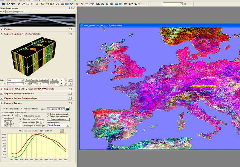
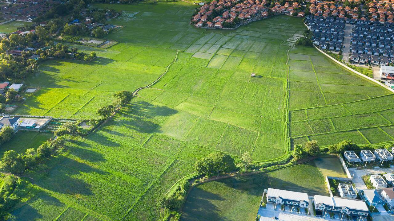
The field of land surveying has evolved significantly over the years, and as we enter 2024, it continues to embrace innovative technologies and practices that enhance accuracy, efficiency, and sustainability.
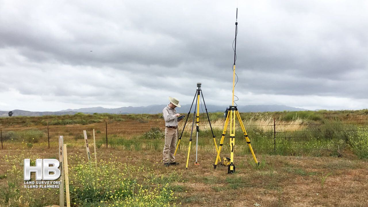
In 2024, land surveyors in Maryland are utilizing cutting-edge tools and techniques to streamline their work. High-precision Global Navigation Satellite Systems (GNSS) receivers have become standard equipment, providing accurate positioning data for surveys. Drones equipped with LiDAR (Light Detection and Ranging) technology are also being used for aerial surveys, making it easier to map large areas and gather detailed elevation data.
Digital mapping and Geographic Information Systems (GIS) have revolutionized […]
Maryland, a state known for its rich history and diverse landscapes, has a land surveying heritage deeply embedded in its past. To truly appreciate the role of land surveying in Maryland’s development, one must delve into its historical roots, understanding how this profession shaped the state’s boundaries, land use, and infrastructure.
Maryland’s land surveying history dates back to the early colonial period when English settlers established the first European settlements in the region during the 17th century. The need for precise property demarcation and land division became apparent as the colony expanded.
In 1723, the colonial government of Maryland passed a law known as the “Act for the Better […]
Getting a survey for your property is crucial. It assures that you don’t require a mortgage if your offer on a house has been approved and accepted, before continuing further.
Property surveys establish or confirm boundary lines, the house’s location, and subsurface features like wells and septic tanks. They also outline additional restrictions and legal requirements, such as such as crossings or incursions.
Therefore, you’ll likely need a property survey when buying a new place or expanding your existing land. Let’s explore the process.
One of the most frequent causes for a landowner to hire a certified inspector for surveying a property […]
Wall Check Surveys are a crucial component of property assessment, providing essential information about boundaries and property corners. In this article, we will explore what Wall Check Surveys are, how they are performed, when they are needed, the circumstances that require them, the latest innovations in the field, and their historical significance.
Wall Check Surveys involve the recovery and verification of property boundaries and corners. These surveys aim to accurately determine the outline of a property, ensuring that any construction, inspections, or repairs are conducted within the appropriate boundaries. By recovering property corners and outlining the, Surveys establish the framework for precise measurements and analysis.
Land surveying is the process of measuring and mapping land and other features of the earth’s surface. It is an essential tool for various purposes such as property disputes, construction, urban planning, and resource management. There are different types of land surveys and methods, each with its own unique characteristics and applications. In this category, we will go through some of the most common land survey types.
Boundary Surveys:
Site surveying is a skillful practice of measuring both the horizontal and vertical distances to approximate the locations of many points on the Earth’s surface.
Along with considering angles and the specifics of these points when crafting a plan or a map at any scale.
Determining a point’s three-dimensional or two-dimensional position on the planet, together with the angles and distances that separate it from other points, is the basis of site surveying. And could start off with a straightforward walkover survey before carrying on to more comprehensive surveys that focus on particular aspects.
The history of land surveying in the United States dates back to the colonial era when the first settlers began to claim and develop land in the new world.
One of the colonies’ first significant land surveying projects was surveying the Mason-Dixon line in the 18th century, which established the boundary between Pennsylvania and Maryland.
This survey, conducted by Charles Mason and Jeremiah Dixon, helped to resolve a long-standing boundary dispute between the two colonies and set a precedent for future boundary surveys in the country.
![An image of a map showing an example of how the history of land surveying played a key role in [...]
</p srcset=](https://haller-blanchard.com/wp-content/uploads/2023/01/history-of-land-survey-united-states-territories-map-1830-300x202.png)
Due to the exponential growth of technological innovation, the future of land surveying and the survey profession is evolving swiftly. Professionals in the present and the future should be aware of these developments and what they signify for their career paths because this trend will undoubtedly continue.
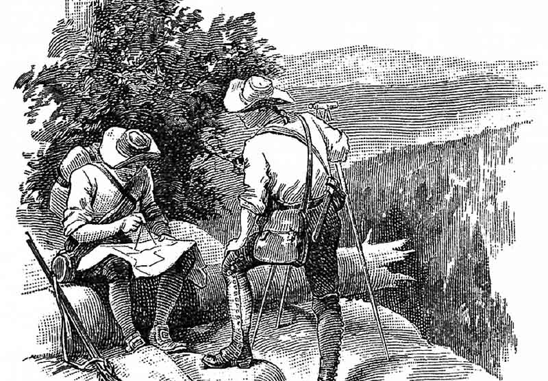
The history of the land surveying profession is extensive and colorful. There has always been a need for surveyors, from Ancient Egypt to the present. But in the current day, we’ve created procedures for doing land surveys that are more precise and effective.
Haller Blanchard has been ![an image of 2 men both on ladders one is looking through a theodolite and the other man is holding a Land [...]
</p srcset=](https://haller-blanchard.com/wp-content/uploads/2018/04/Survey-Estimates-300x300.jpg)