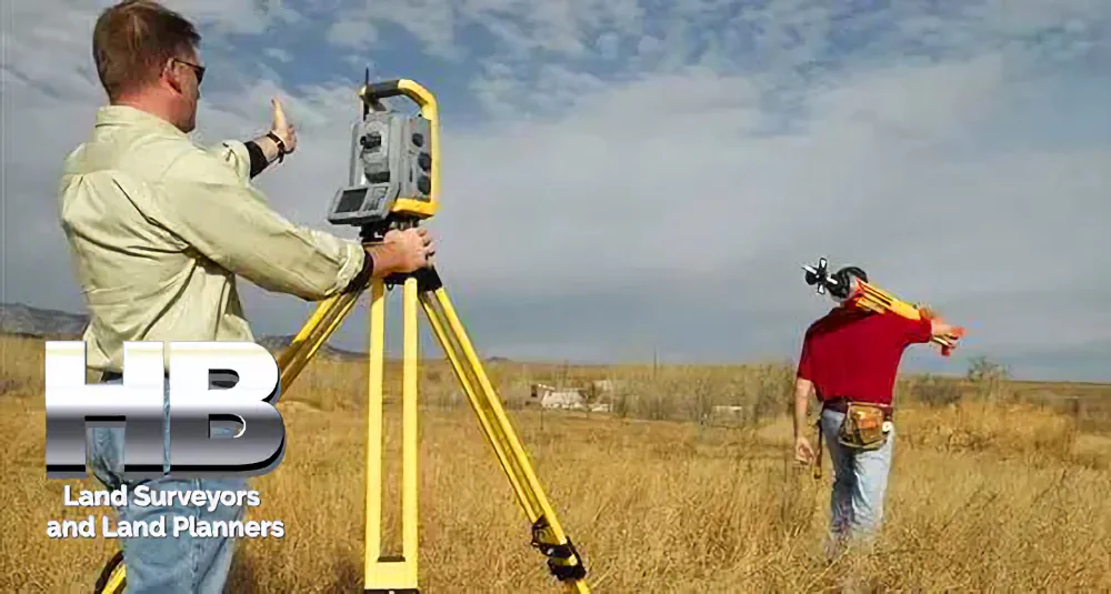
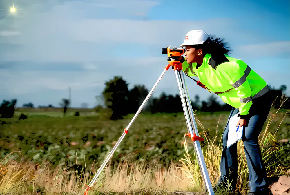
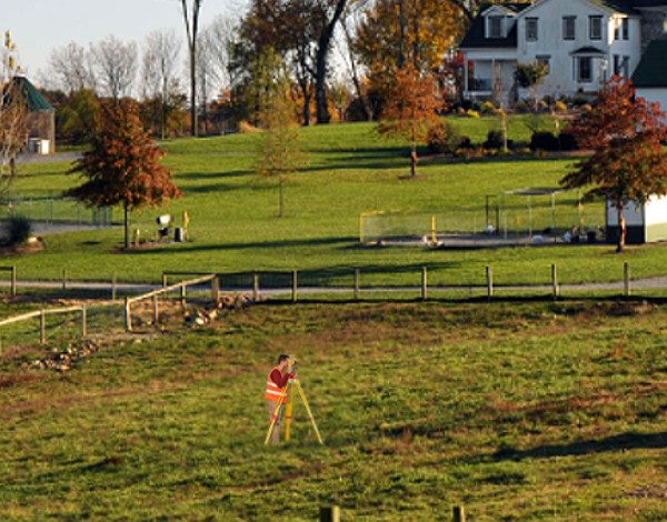
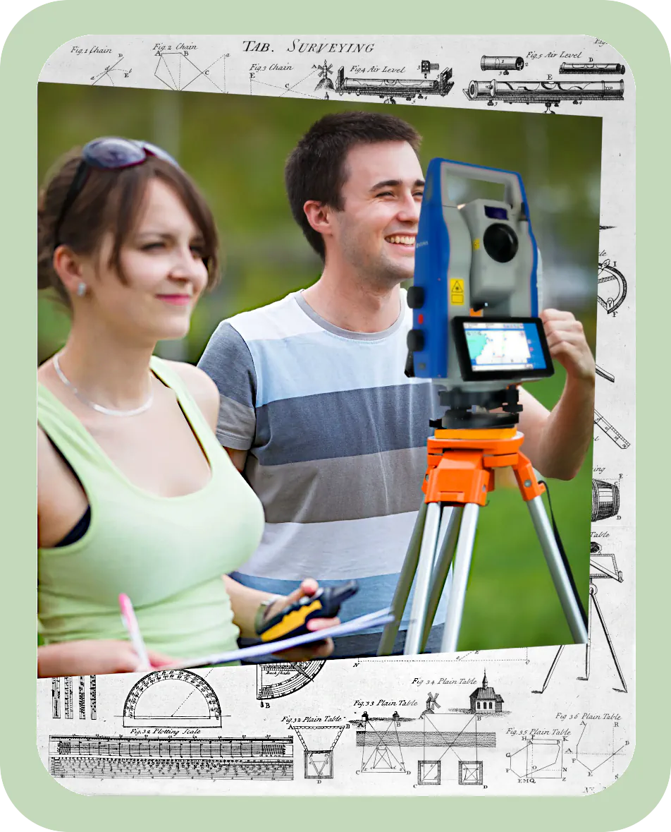
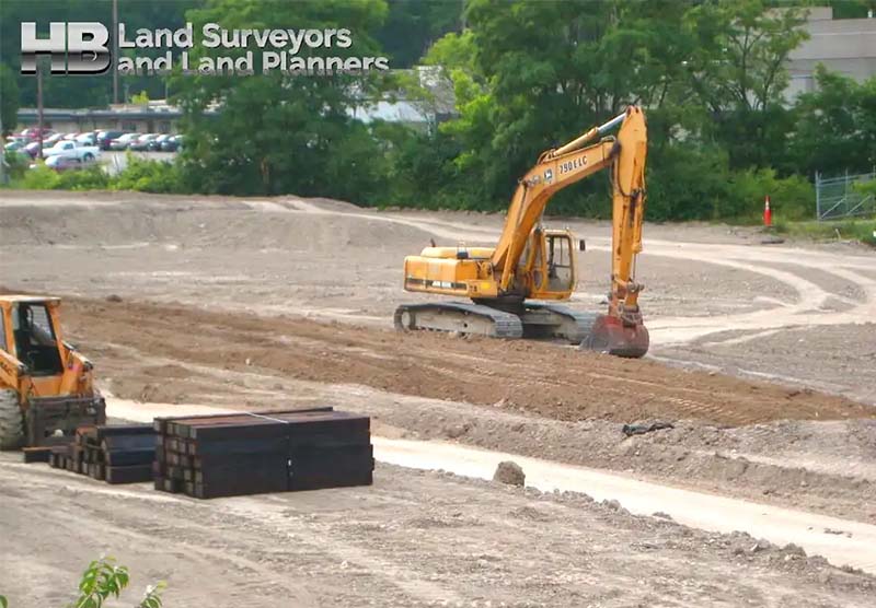
Land surveys are essential for construction, property transactions, and urban planning.

Recent advancements in technology are transforming traditional surveying methods, enhancing precision, speed, and reliability. Here’s a look at what’s new and on the horizon for the surveying industry.

2. Drones and UAV Surveying

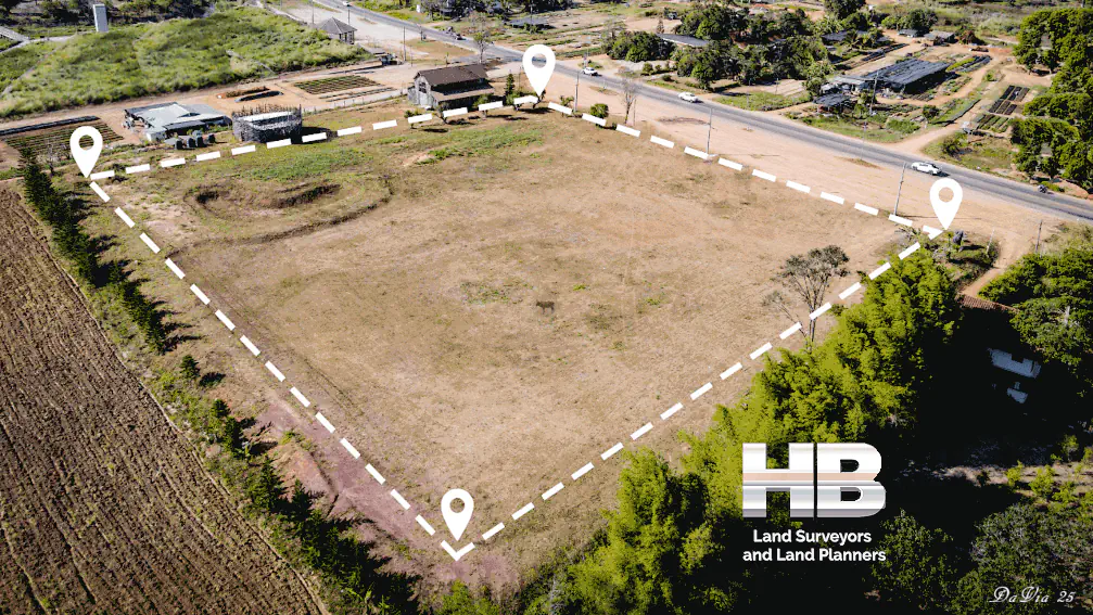
Drones, or unmanned aerial vehicles (UAVs), have revolutionized land surveying by enabling aerial imaging, mapping, and 3D modeling.

Equipped with high-resolution cameras and LiDAR (Light Detection and Ranging) technology, drones can capture large areas with remarkable accuracy. This is especially valuable for boundary surveys, as drones can quickly cover expansive properties that may be challenging to access on foot.An image of a sunny summer dat with a Man of Color in the forefront of the image, he is performing a As-Built Survey he is looking through a orange theodolite mounted on a tripod, he has a slight grin, he looks happy

Using drones allows surveyors to complete tasks in hours instead of days.

These devices are also proving useful for topographic surveys, where 3D images provide detailed elevation data for construction planning. As drone technology advances, expect to see more automated, AI-powered drones capable of performing complex surveying tasks independently.

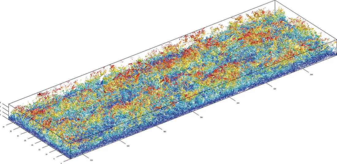
3. 3D Laser Scanning and LiDAR Technology

Laser scanning, particularly through LiDAR, is another transformative technology in land surveying.

LiDAR systems send out laser pulses and measure the reflection times to create precise, high-resolution 3D models of a landscape or structure. This technology is valuable for stake-out surveys, wall-checks, and other projects where extreme accuracy is required.

LiDAR is especially beneficial in urban environments or difficult terrains where traditional surveying may be challenging. Surveyors can gather millions of data points quickly, reducing the need for repeat visits.

With advancements in portable LiDAR equipment, surveyors can now bring this technology to even more sites, offering faster and more detailed results.

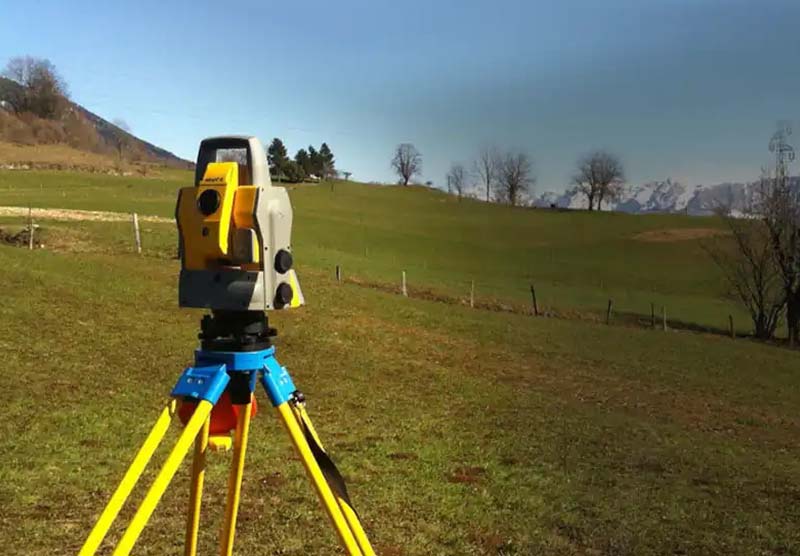
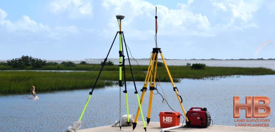
4. Geospatial and GNSS Technology

Geospatial and GNSS (Global Navigation Satellite System) technology are taking surveying accuracy to the next level.

GNSS receivers work alongside satellite systems like GPS, GLONASS, and Galileo to provide high-accuracy location data in real-time. This technology is a game-changer for boundary surveys, enabling surveyors to pinpoint property lines with exceptional accuracy.

In combination with Geographic Information Systems (GIS)

A very colorful image of a man performing a NSPS Survey near Frederick Maryland with the text GNSS data allows surveyors to create comprehensive maps and datasets that can be stored and shared digitally. On the horizon, developments in GNSS and satellite technology will improve signal strength, allowing surveyors to work more effectively in dense urban areas or forests where signals are traditionally weak.

5. Augmented Reality (AR) and Surveying Software

Augmented reality (AR) is entering the world of surveying, providing new ways to visualize and interact with data on-site.

AR can overlay digital models of boundaries or structures onto real-world landscapes, helping surveyors and clients alike understand the spatial relationships in a project area. This can be particularly useful for NSPS surveys and construction stake-outs, where seeing a visual representation of the planned construction can ensure accuracy before breaking ground.

Lastly, advancements in surveying software are also making data processing more efficient.

Programs like AutoCAD Civil 3D and Trimble Business Center allow surveyors to create detailed 3D models, adjust plans quickly, and collaborate with other teams more effectively. As AR and software technology develop, surveyors will have even more powerful tools to streamline workflows and enhance accuracy.

  • Making the Right Choice: How Google Simplifies Finding the Perfect Surveyor

    [break] Making the Right Choice: How Google Simplifies Finding the Perfect Surveyor If you're thinking you need a property survey and you search for a surveyor in Google with 'surveyor near me,' you will [...]

  • Beyond the Search: How Google Facilitates an Informed Surveyor Selection Process

    Beyond the Search: How Google Facilitates an Informed Surveyor Selection Process The task of reviewing property surveyors and selecting one, critical in various real estate transactions, has been significantly streamlined by the advent of [...]

  • land surveying equipment out on field conducting a survey

    Land Surveying: Advancements, Innovations and Future Prospects

    Land Survey Technology Advancements and the Future of Land Survey Services Land surveying, a time-honored profession, has undergone significant transformations in recent years due to advancements in technology. These developments have not only improved [...]

  • land survey operation in Frederick, Maryland

    A Land Surveyor’s Role in Site Development

    A Land Surveyor’s Role in Site Development The Pivotal Role Played in Construction Site Surveying 1. Introduction to Land Surveyors in Development Land surveyors play a pivotal role in development projects, tackling the question [...]

  • A theodolite use for land surveys is set-up on a large mound of brown coarse earth with a forest of green pine or fir trees in the distance.

    What are Land Surveys?

    What Are Land Surveys? A land survey is often done when a property is bought or sold, a mortgage is obtained, or a boundary dispute arises. Land surveys can also be conducted for construction [...]

  • An African American woman wearing dark glasses and a cloth face mask looks through a theodolite to perform topographical land surveys.

    Topographical Land Surveys

    Topographic Land SurveysTopographic Land Surveys are important for finding the various features and elevations of a property before beginning any substantial construction/development project or environmental improvement project. With the highest level of accuracy, Haller Blanchard [...]

  • Surveyor Near Me

    Land Surveyor Near Me, an often-used Keyword Search Phrase. Given the fact Hall, Blanchard and Associates are the oldest Land Survey and Land Planning Company in all of West-Central Maryland, you might think HBA [...]

  • a painting of the frederick, maryland skyline, it's very pleasing to the eye, the hills in the background all have a frost covering but down in the town the trees are green and the colors are vibrant.

    What happens when you search the web for “surveyors near me” or “land surveyor near me”?

    What Really Happens When You Search The Phrase “Surveyors Near Me” or “Land Surveyor Near Me” behind the scenes? Like so many people today, when in need of a Professional Land Surveyor near you, [...]

  • A aerial image of a plot with the outline of the property.

    The Evolution of Land Survey Services in 2025

    The Evolution of Land Survey Services in 2025 The field of land surveying is poised for significant changes in 2024, driven by technological advancements, regulatory shifts, and the increasing demand for accurate geospatial data. In [...]

  • an image of Woman Land Surveyor standing in a construction zone performing a land survey, its a sunny summer day in Rockville Maryland

    Land Survey in Rockville, Maryland

    Land Survey in Rockville, Maryland Rockville, Maryland—now a bustling suburb of Washington, D.C.—has a rich history of land surveying that reflects broader patterns of settlement, land use, and urban development in the Mid-Atlantic region. [...]

  • AN image of 3 surveyors working together. A black female, a spanish man, and a woman from india all working together a land surveyors of Haller Blanchard. They all look happy to be there.

    Maryland’s Premier Land Survey Company Celebrating 40 Years of Excellence

    Maryland’s Premier Land Survey Company Haller, Blanchard, and Associates As Maryland’s Premier Land Survey Company and the oldest and most trusted surveying firm, Haller-Blanchard has established an enduring legacy of excellence throughout its 40-year [...]

  • An african american man using a theodolite on a beautiful summer day he is working at a construction site.

    Good Survey Company- And What Makes it Good

    Good Survey Company, What makes us great! 1. Expertise and Qualifications Good Survey Companies are characterized by its team of highly qualified and experienced professionals. These experts should have the necessary certifications and licenses [...]

  • Team reviews plan for smart city development - a land surveying opportunity in 2025

    Challenges and Opportunities in Land Survey Services in 2024

    Land Surveying in 2024 - Opportunities and Challenges In Part 1, we explored some of the key trends and advancements expected to impact land survey services in 2024. In this continuation, we will discuss [...]

  • An image of a red sky sunset and a man conducting a survey looking through his theodolite in a shadowed silhouette with the caption " In a world where feature and price can be easily matched if not exceeded, it is the customer experience that sets Haller, Blanchard and Associates apart from the competition." And underneath that text in a much larger font "Since 1985". "

    Land Surveyor – Understanding the Importance

    Land Surveyor - How to Find A Good One Finding a good land surveyor is crucial for any property-related project. Whether you're purchasing a new piece of land, building a home, or subdividing a [...]

  • A aerial image of a plot with the outline of the property.

    The Evolution of Land Survey Services in 2024

    The Evolution of Land Survey Services in 2024 The field of land surveying is poised for significant changes in 2024, driven by technological advancements, regulatory shifts, and the increasing demand for accurate geospatial data. [...]

  • Making the Right Choice: How Google Simplifies Finding the Perfect Surveyor

    [break] Making the Right Choice: How Google Simplifies Finding the Perfect Surveyor If you're thinking you need a property survey and you search for a surveyor in Google with 'surveyor near me,' you will [...]

  • Beyond the Search: How Google Facilitates an Informed Surveyor Selection Process

    Beyond the Search: How Google Facilitates an Informed Surveyor Selection Process The task of reviewing property surveyors and selecting one, critical in various real estate transactions, has been significantly streamlined by the advent of [...]

  • land surveying equipment out on field conducting a survey

    Land Surveying: Advancements, Innovations and Future Prospects

    Land Survey Technology Advancements and the Future of Land Survey Services Land surveying, a time-honored profession, has undergone significant transformations in recent years due to advancements in technology. These developments have not only improved [...]

  • land survey operation in Frederick, Maryland

    A Land Surveyor’s Role in Site Development

    A Land Surveyor’s Role in Site Development The Pivotal Role Played in Construction Site Surveying 1. Introduction to Land Surveyors in Development Land surveyors play a pivotal role in development projects, tackling the question [...]

  • Land survey data analytics reviewing map characteristics

    The Future of Land Survey Companies and Surveyors

    The Future of Land Survey Companies and Surveyors As we look to the future, the landscape of land surveying in Maryland is poised for further transformation. Technological advancements, changing regulations, and evolving client demands are [...]

  • Land surveying GIS technology monitoring seasonal trends

    What’s New in Land Surveying in 2024

    What's New in Land Surveying in 2024 The field of land surveying has evolved significantly over the years, and as we enter 2024, it continues to embrace innovative technologies and practices that enhance accuracy, [...]

  • History of land survey - Mason and Dixon

    Land Survey History in Maryland: Tracing Its Foundations

    Land Survey History in Maryland - Tracing the Foundations Maryland, a state known for its rich history and diverse landscapes, has a land surveying heritage deeply embedded in its past. To truly appreciate the [...]

  • Property Survey Boundaries Drawing

    Property Surveys: Why You Need One and How to Get It Done Right

    Property Surveys: Why You Need One and How to Get It Done Right Getting a survey for your property is crucial. It assures that you don't require a mortgage if your offer on a [...]

  • An image of 2 tripods with radio connection survey devices, the background is a beautiful lake and cat tail wet-land there is a large mouth bass jumping out of the lake and there is a very slight rainbow, it's a really cool image!
  • An african american woman performing a wall check survey it's a beautiful summer day

    Wall Check Surveys, What Are They?

    Introduction: Wall Check Surveys are a crucial component of property assessment, providing essential information about boundaries and property corners. In this article, we will explore what Wall Check Surveys are, how they are performed, [...]

  • The future of property surveys an aerial view of new development neighborhood and it's property line
  • One young, attractive woman smiling in a rural scenic area only looking directly at camera holding a surveyors level measurement tool wearing reflective surveying industrial clothing and protective headwear.

    Site Surveying – What and Why?

    Site Surveying: What and Why? Site surveying is a skillful practice of measuring both the horizontal and vertical distances to approximate the locations of many points on the Earth's surface. Along with considering angles [...]

  • An image of a green expanse of grass with plot lines showing in the grass and developed lots with housing around the periphery.

    The History of Land Surveying in the United States

    Land Surveying and the Expansion of the United States The history of land surveying in the United States dates back to the colonial era when the first settlers began to claim and develop land [...]

  • A man stands in a field looking at a tablet and configuring settings for two communicating pieces of modern land surveying quipment.

    The Future of Land Surveying

    The Future of Land Surveying Due to the exponential growth of technological innovation, the future of land surveying and the survey profession is evolving swiftly. Professionals in the present and the future should be [...]

  • A theodolite use for land surveys is set-up on a large mound of brown coarse earth with a forest of green pine or fir trees in the distance.

    What are Land Surveys?

    What Are Land Surveys? A land survey is often done when a property is bought or sold, a mortgage is obtained, or a boundary dispute arises. Land surveys can also be conducted for construction [...]

  • An African American woman wearing dark glasses and a cloth face mask looks through a theodolite to perform topographical land surveys.

    Topographical Land Surveys

    Topographic Land SurveysTopographic Land Surveys are important for finding the various features and elevations of a property before beginning any substantial construction/development project or environmental improvement project. With the highest level of accuracy, Haller Blanchard [...]

  • Male Construction Worker Completing a Stakeout Survey

    Stakeout Surveys

    What Are Construction Stakeout Surveys And How Does It Help Construction Projects? Construction stakeout surveys refer to the technique of using driven stakes to establish ground survey sites during a physical or boundary survey. [...]

  • A aerial image of a plot with the outline of the property.

    The Evolution of Land Survey Services in 2025

    The Evolution of Land Survey Services in 2025 The field of land surveying is poised for significant changes in 2024, driven by technological advancements, regulatory shifts, and the increasing demand for accurate geospatial data. In [...]

  • an image of Woman Land Surveyor standing in a construction zone performing a land survey, its a sunny summer day in Rockville Maryland

    Land Survey in Rockville, Maryland

    Land Survey in Rockville, Maryland Rockville, Maryland—now a bustling suburb of Washington, D.C.—has a rich history of land surveying that reflects broader patterns of settlement, land use, and urban development in the Mid-Atlantic region. [...]

  • AN image of 3 surveyors working together. A black female, a spanish man, and a woman from india all working together a land surveyors of Haller Blanchard. They all look happy to be there.

    Maryland’s Premier Land Survey Company Celebrating 40 Years of Excellence

    Maryland’s Premier Land Survey Company Haller, Blanchard, and Associates As Maryland’s Premier Land Survey Company and the oldest and most trusted surveying firm, Haller-Blanchard has established an enduring legacy of excellence throughout its 40-year [...]

  • Team reviews plan for smart city development - a land surveying opportunity in 2025

    Challenges and Opportunities in Land Survey Services in 2024

    Land Surveying in 2024 - Opportunities and Challenges In Part 1, we explored some of the key trends and advancements expected to impact land survey services in 2024. In this continuation, we will discuss [...]

  • A aerial image of a plot with the outline of the property.

    The Evolution of Land Survey Services in 2024

    The Evolution of Land Survey Services in 2024 The field of land surveying is poised for significant changes in 2024, driven by technological advancements, regulatory shifts, and the increasing demand for accurate geospatial data. [...]

  • Making the Right Choice: How Google Simplifies Finding the Perfect Surveyor

    [break] Making the Right Choice: How Google Simplifies Finding the Perfect Surveyor If you're thinking you need a property survey and you search for a surveyor in Google with 'surveyor near me,' you will [...]

  • Beyond the Search: How Google Facilitates an Informed Surveyor Selection Process

    Beyond the Search: How Google Facilitates an Informed Surveyor Selection Process The task of reviewing property surveyors and selecting one, critical in various real estate transactions, has been significantly streamlined by the advent of [...]

  • land surveying equipment out on field conducting a survey

    Land Surveying: Advancements, Innovations and Future Prospects

    Land Survey Technology Advancements and the Future of Land Survey Services Land surveying, a time-honored profession, has undergone significant transformations in recent years due to advancements in technology. These developments have not only improved [...]