The future of land surveys
The future of land surveys in Maryland
The future of land surveys, the people, the equipment, the process, why we love it, the legal and regulatory issues and more.


![]()

The future of land surveys, the people, the equipment, the process, why we love it, the legal and regulatory issues and more.
![]()
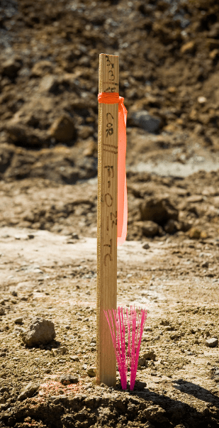
A land survey is often done when a property is bought or sold, a mortgage is obtained, or a boundary dispute arises. Land surveys can also be conducted for construction projects, to create maps, or to establish legal descriptions for a property.
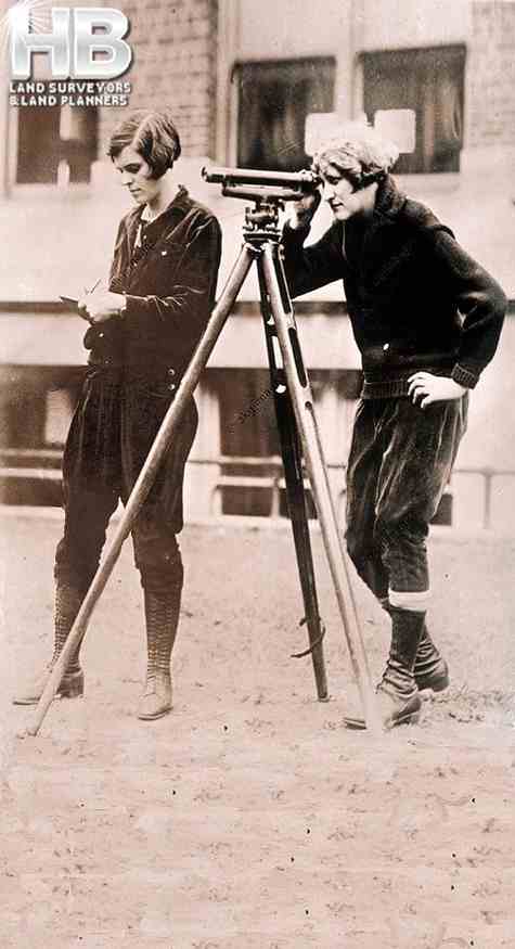
 click on the image to learn some interesting history about land surveys and the instruments they used in the 18th and 19th centuries.
There are many types of land surveys, including boundary surveys, topographic surveys, and mortgage location certificates. A […]
Topographic Land Surveys are important for finding the various features and elevations of a property before beginning any substantial construction/development project or environmental improvement project. With the highest level of accuracy, Haller Blanchard & Associates Land Surveyors has many years of experience doing this type of Survey. Additionally, our Land Surveyors in Maryland provide a vast array of precise and reasonably priced Topo Survey services.
We provide superior surveys delivered on time and meet or exceed local and state criteria. We have the knowledge and experience to ensure that Surveys are done correctly, whether you require a straightforward Topographic, Boundary, Stake Out, ALTA Survey, or As-Built Survey.
In addition, our Land Surveyors continue to play a crucial role in the development of our […]
Construction stakeout surveys refer to the technique of using driven stakes to establish ground survey sites during a physical or boundary survey. Haller Blanchard Surveyors uses stakes to determine the boundaries and elevations of a home or commercial construction project. We pre-calculate the land area’s design measurements and physically mark them on-site. These stakes show elevations, lateral positioning, orientation, and grading for roads, pathways, homes, landscape, drains, and other requirements, determining the physical qualities for developing.
Haller Blanchard’s stakeout survey service experience includes everything from single and multi-family home or construction […]
Given the fact Hall, Blanchard and Associates are the oldest Land Survey and Land Planning Company in all of West-Central Maryland, you might think HBA would be at the top of Google when searching for “Land Surveyors Near Me” by default.
But that’s not how the internet works.
Since 1985, and for 39 Years, HBA has been serving Frederick Maryland, which is long before the internet became mainstream. And well before the 1st official website was launched in 1995. Also, see. History of the World Wide Web.
And in the vernacular of youth. “Back in the day”, Haller, Blanchard, and Associates used the typical methods or channels of marketing. E.g. Snail Mail, Phone Books, Targeted […]
At Haller-Blanchard and Associates we provide a wide scope of land survey services. Anything from lot stake-out surveys to topographic surveys, and almost everything in between. One of the main specialized services we provide as a land survey company is subdivision land surveys.
Land surveying will always involve depicting the legal borders of your property. It can include a variety of other things as well, depending on what the survey is for. Things like easements, important land features, infringements from other properties, etc. But what is it that makes subdivision land surveys a little bit different?
The general purpose of this type […]
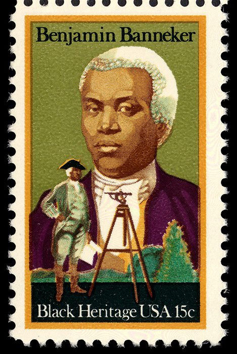
Benjamin Banneker is often referred
to as America’s 1st black scientist.
He was also a land surveyor.
A land survey helps you understand the many facets and details of your land. Land surveys are used to locate, characterize, commemorate, and map a portion of the land’s boundaries. It could also contain the land’s terrain, the position of buildings, and other improvements.
A land survey is the foundation or one of the first steps of any construction project.
Professional land surveyors are trained to define property boundaries using a complex combination of law, mathematics, technology, and the sciences.
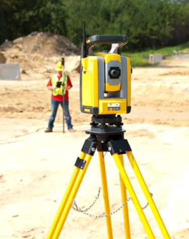
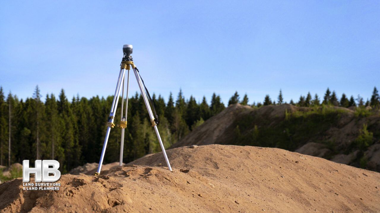
We conduct surveys, using specialized equipment such as GPS, Theodolites, Laser Technology, and Software.
 Experienced Professional Land Surveyors
In West Central […]

Like so many people today, when in need of a Professional Land Surveyor near you, an internet search like, “land surveyors near me”, or “survey companies near me”, is the first and only source people use.
And in fact, an internet search is, by a significant percentage, the most popular choice. The number of people still using the hardcopy of the Yellow Pages or a local phone directory grows ever smaller each day. The internet is faster, with more options, and with more information like company reviews.
And the “About” page can be a good source for […]


