A Land Surveyor’s Role in Site Development

A Land Surveyor’s Role in Site Development

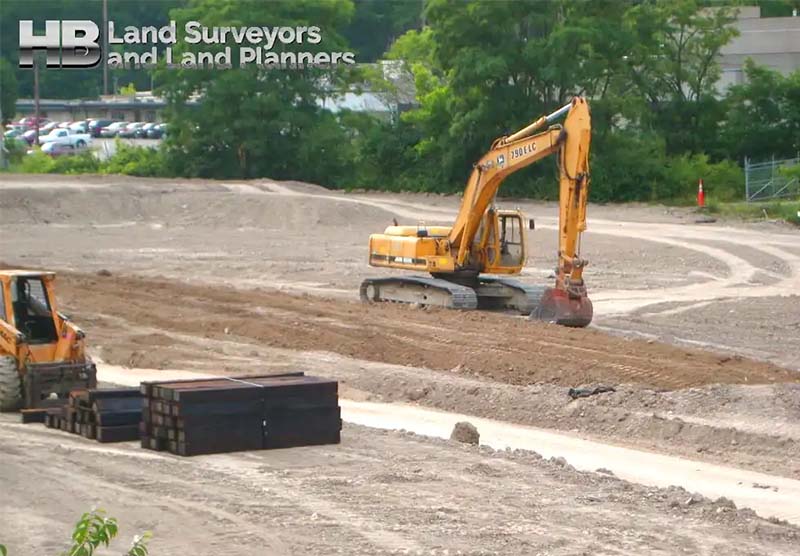
The Pivotal Role Played in Construction Site Surveying

1. Introduction to Land Surveyors in Development

Land surveyors play a pivotal role in development projects, tackling the question of ‘What goes where and when?’

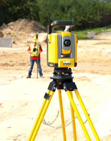
This ancient profession, extending over thousands of years, encompasses a range of activities from hydrographic surveys to high-altitude aerial mapping. Today, their expertise is integral to technologies such as GPS and mobile navigation. With the recent revival in construction, the demand for Construction Staking Services has significantly increased.”

2. The Role of Land Surveyors in Site Development

In the realm of site development, the contributions of land surveyors are indispensable. They convert the designs of architects and engineers into tangible markers onsite, directing […]

A Land Surveyor’s Role in Site Development2024-11-19T16:26:52-05:00

Types of Land Surveys


Types of Land Surveys

Land surveying is the process of measuring and mapping land and other features of the earth’s surface. It is an essential tool for various purposes such as property disputes, construction, urban planning, and resource management. There are different types of land surveys and methods, each with its own unique characteristics and applications. In this category, we will go through some of the most common land survey types.

Most Common Types of Land Surveys

Boundary Surveys:

  • Boundary surveys are among the most common types of land surveying, and their purpose is to establish property lines and boundaries. These surveys involve measuring and mapping the property’s corners. And property lines, which are […]
Types of Land Surveys2025-06-15T17:50:17-04:00

What are Land Surveys?

What Are Land Surveys?

A land survey is often done when a property is bought or sold, a mortgage is obtained, or a boundary dispute arises. Land surveys can also be conducted for construction projects, to create maps, or to establish legal descriptions for a property.

an image of a Great Theodolite of 1787 it looks like a turnable carousel with a compass and raised indicators click on the image to learn some interesting history about land surveys and the instruments they used in the 18th and 19th centuries.

Types of Land Surveys

There are many types of land surveys, including boundary surveys, topographic surveys, and mortgage location certificates. A […]

What are Land Surveys?2025-11-06T07:51:47-05:00

Topographical Land Surveys

Topographic Land Surveys

Topographic Land Surveys are important for finding the various features and elevations of a property before beginning any substantial construction/development project or environmental improvement project. With the highest level of accuracy, Haller Blanchard & Associates Land Surveyors has many years of experience doing this type of Survey. Additionally, our Land Surveyors in Maryland provide a vast array of precise and reasonably priced Topo Survey services.

We provide superior surveys delivered on time and meet or exceed local and state criteria. We have the knowledge and experience to ensure that Surveys are done correctly, whether you require a straightforward Topographic, Boundary, Stake Out, ALTA Survey, or As-Built Survey.

In addition, our Land Surveyors continue to play a crucial role in the development of our […]

Topographical Land Surveys2023-11-16T23:00:00-05:00

Surveyor Near Me

Land Surveyor Near Me, an often-used Keyword Search Phrase.

Given the fact Hall, Blanchard and Associates are the oldest Land Survey and Land Planning Company in all of West-Central Maryland, you might think HBA would be at the top of Google when searching for “Land Surveyors Near Me” by default.

But that’s not how the internet works.

Since 1985, and for 39 Years, HBA has been serving Frederick Maryland, which is long before the internet became mainstream. And well before the 1st official website was launched in 1995. Also, see. History of the World Wide Web.

And in the vernacular of youth. “Back in the day”, Haller, Blanchard, and Associates used the typical methods or channels of marketing. E.g. Snail Mail, Phone Books, Targeted […]

Surveyor Near Me2023-11-16T23:04:45-05:00

A Land Survey – The Foundation of any Construction Project

What is a land survey?

A land survey helps you understand the many facets and details of your land. Land surveys are used to locate, characterize, commemorate, and map a portion of the land’s boundaries. It could also contain the land’s terrain, the position of buildings, and other improvements.

A land survey is the foundation or one of the first steps of any construction project.

Professional land surveyors are trained to define property boundaries using a complex combination of law, mathematics, technology, and the sciences.

We conduct surveys, using specialized equipment such as GPS, Theodolites, Laser Technology, and Software.

A survey expert on a construction site holding a clipboard while another expert surveyor looks through a theodoliteExperienced Professional Land Surveyors

In West Central […]

A Land Survey – The Foundation of any Construction Project2024-11-20T16:02:04-05:00

What happens when you search the web for “surveyors near me” or “land surveyor near me”?

What Really Happens When You Search The Phrase “Surveyors Near Me” or “Land Surveyor Near Me” behind the scenes?

Like so many people today, when in need of a Professional Land Surveyor near you, an internet search like, “land surveyors near me”, or “survey companies near me”, is the first and only source people use.

And in fact, an internet search is, by a significant percentage, the most popular choice. The number of people still using the hardcopy of the Yellow Pages or a local phone directory grows ever smaller each day. The internet is faster, with more options, and with more information like company reviews.

And the “About” page can be a good source for […]

What happens when you search the web for “surveyors near me” or “land surveyor near me”?2024-11-20T14:54:54-05:00
Go to Top