The tag – “land surveyor near me”
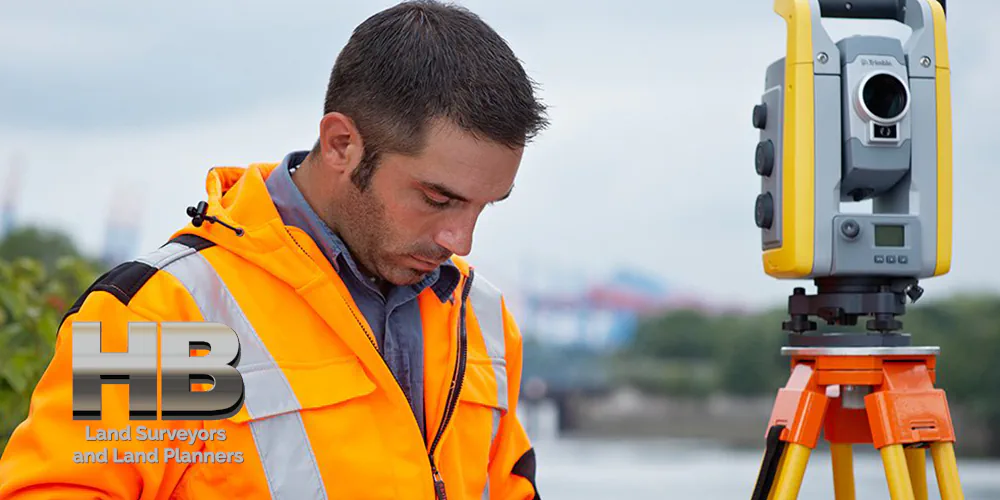
A very colorful image of a man performing a ALTA Survey near Frederick Maryland with the text is a much-used keyword phase because it is simple, easy, and produces the results people are looking for when in need of a product or service. In our case a Land Survey Company. We attach this tag to the pages and articles that are the best, most appropriate match.

Land Surveyor – Understanding the Importance

Land Surveyor – How to Find A Good One

Finding a good land surveyor is crucial for any property-related project.

Whether you’re purchasing a new piece of land, building a home, or subdividing a lot, a professional land surveyor provides the precise measurements and boundaries essential for legal and construction purposes.

A qualified surveyor ensures that all the property’s legal descriptions match the physical realities on the ground, preventing future disputes and ensuring compliance with local regulations.

Key Qualities to Look For When HiringA SurveyorA aerial image of a plot with the outline of the  [...]</body></html>

Land Surveyor – Understanding the Importance2025-01-20T16:34:12-05:00

Making the Right Choice: How Google Simplifies Finding the Perfect Surveyor

[break]

Making the Right Choice: How Google Simplifies Finding the Perfect Surveyor

If you’re thinking you need a property survey and you search for a surveyor in Google with ‘surveyor near me,’ you will see plenty of options. But Google helps with the decision-making, and here’s how.

In the modern era of digital convenience, the task of finding a professional service, such as a property surveyor, has transformed significantly. Google, the ubiquitous search engine, not only presents a plethora of choices but also aids in refining and simplifying the decision-making process. This essay explores how Google streamlines the search for a reliable property surveyor, ensuring that homeowners and property investors make well-informed decisions.

Find Companies Near You

Firstly, Google’s powerful search algorithm provides localized results. Typing […]

Making the Right Choice: How Google Simplifies Finding the Perfect Surveyor2025-06-15T19:58:06-04:00

Beyond the Search: How Google Facilitates an Informed Surveyor Selection Process

Beyond the Search: How Google Facilitates an Informed Surveyor Selection Process

The task of reviewing property surveyors and selecting one, critical in various real estate transactions, has been significantly streamlined by the advent of digital tools, particularly Google’s search engine. This essay delves into the multifaceted role that Google plays in assisting individuals in choosing the most suitable property surveyor for their needs.

Location-Based Search Results

To start with, Google’s search results are tailored to the user’s location, offering a curated list of nearby surveyors. This geolocation feature is invaluable, especially for property-related services where local knowledge and proximity are key. By delivering results specific to the user’s area, Google ensures that the options provided are not only relevant but also convenient.

User […]

Beyond the Search: How Google Facilitates an Informed Surveyor Selection Process2024-11-19T16:24:23-05:00

Land Surveying: Advancements, Innovations and Future Prospects

Land Survey Technology Advancements and the Future of Land Survey Services

Land surveying, a time-honored profession, has undergone significant transformations in recent years due to advancements in technology.

These developments have not only improved the accuracy and efficiency of land surveying but have also paved the way for exciting future possibilities.

In addition to technological innovations, it is essential to consider the diversity within the profession, including the current racial demographics among land surveyors.

[break]

Land Surveying Advancements and Recent Innovations

Land surveying has traditionally relied on manual methods, such as theodolites and total stations, which are still used today but have been complemented and, in some cases, replaced by more advanced technologies.

One of the most notable advancements is the use of Global Navigation Satellite Systems (GNSS), […]

Land Surveying: Advancements, Innovations and Future Prospects2024-11-19T16:25:42-05:00

A Land Surveyor’s Role in Site Development

A Land Surveyor’s Role in Site Development

The Pivotal Role Played in Construction Site Surveying

1. Introduction to Land Surveyors in Development

Land surveyors play a pivotal role in development projects, tackling the question of ‘What goes where and when?’

This ancient profession, extending over thousands of years, encompasses a range of activities from hydrographic surveys to high-altitude aerial mapping. Today, their expertise is integral to technologies such as GPS and mobile navigation. With the recent revival in construction, the demand for Construction Staking Services has significantly increased.”

2. The Role of Land Surveyors in Site Development

In the realm of site development, the contributions of land surveyors are indispensable. They convert the designs of architects and engineers into tangible markers onsite, directing […]

A Land Surveyor’s Role in Site Development2024-11-19T16:26:52-05:00

Types of Land Surveys


Types of Land Surveys

Land surveying is the process of measuring and mapping land and other features of the earth’s surface. It is an essential tool for various purposes such as property disputes, construction, urban planning, and resource management. There are different types of land surveys and methods, each with its own unique characteristics and applications. In this category, we will go through some of the most common land survey types.

Most Common Types of Land Surveys

Boundary Surveys:

  • Boundary surveys are among the most common types of land surveying, and their purpose is to establish property lines and boundaries. These surveys involve measuring and mapping the property’s corners. And property lines, which are […]
Types of Land Surveys2025-06-15T17:50:17-04:00

What are Land Surveys?

What Are Land Surveys?

A land survey is often done when a property is bought or sold, a mortgage is obtained, or a boundary dispute arises. Land surveys can also be conducted for construction projects, to create maps, or to establish legal descriptions for a property.

Types of Land Surveys

There are many types of land surveys, including boundary surveys, topographic surveys, and mortgage location certificates. A boundary survey is the most common type of land survey used to determine the precise location of a property’s boundaries. A topographic survey is a detailed survey that shows a piece of land’s natural and manufactured features, including elevations, contours, and structures. A mortgage location certificate is a simplified survey typically required by mortgage lenders to confirm the location of a […]

What are Land Surveys?2023-09-17T06:37:17-04:00

Topographical Land Surveys

Topographic Land Surveys

Topographic Land Surveys are important for finding the various features and elevations of a property before beginning any substantial construction/development project or environmental improvement project. With the highest level of accuracy, Haller Blanchard & Associates Land Surveyors has many years of experience doing this type of Survey. Additionally, our Land Surveyors in Maryland provide a vast array of precise and reasonably priced Topo Survey services.

We provide superior surveys delivered on time and meet or exceed local and state criteria. We have the knowledge and experience to ensure that Surveys are done correctly, whether you require a straightforward Topographic, Boundary, Stake Out, ALTA Survey, or As-Built Survey.

In addition, our Land Surveyors continue to play a crucial role in the development of our […]

Topographical Land Surveys2023-11-16T23:00:00-05:00

As-Built Surveys

As-Built Survey

Reasons To Perform This Survey For Your Construction Project

During construction, an As-Built Survey is a record of the location of improvements “as they are built.” Construction improvements such as sewer pipes, buildings, utilities, and pavement may be installed in locations other than those specified in the original plan.

An image of a sunny summer dat with a Man of Color in the forefront of the image, he is performing a As-Built Survey he is looking through a orange theodolite mounted on a tripod, he has a slight grin, he looks happy

As-Built Surveys2023-11-16T23:03:01-05:00

Surveyor Near Me

Land Surveyor Near Me, an often-used Keyword Search Phrase.

Given the fact Hall, Blanchard and Associates are the oldest Land Survey and Land Planning Company in all of West-Central Maryland, you might think HBA would be at the top of Google when searching for “Land Surveyors Near Me” by default.

But that’s not how the internet works.

Since 1985, and for 39 Years, HBA has been serving Frederick Maryland, which is long before the internet became mainstream. And well before the 1st official website was launched in 1995. Also, see. History of the World Wide Web.

And in the vernacular of youth. “Back in the day”, Haller, Blanchard, and Associates used the typical methods or channels of marketing. E.g. Snail Mail, Phone Books, Targeted […]

Surveyor Near Me2023-11-16T23:04:45-05:00
Go to Top