The future of land surveys
The future of land surveys in Maryland
The future of land surveys, the people, the equipment, the process, why we love it, the legal and regulatory issues and more.


![]()

The future of land surveys, the people, the equipment, the process, why we love it, the legal and regulatory issues and more.
![]()

As Maryland’s Premier Land Survey Company and the oldest and most trusted surveying firm, Haller-Blanchard has established an enduring legacy of excellence throughout its 40-year history. Founded in Fredericks, Maryland, the company has become a cornerstone of the local surveying industry, renowned for its commitment to precision, innovation, and exceptional service.
Haller-Blanchard’s journey began four decades ago, rooted in a deep understanding of the unique landscape and regulatory environment of west-central Maryland. Over the years, they have built a reputation not only for their technical expertise but also for their longstanding relationships with local, county, state, and city officials. These relationships enable the company to navigate permitting and approvals swiftly and smoothly, giving […]
Good Survey Companies are characterized by its team of highly qualified and experienced professionals.
These experts should have the necessary certifications and licenses to perform land surveys.
Their expertise ensures that the surveys are conducted accurately and in compliance with local regulations.
Additionally, a reputable company continuously invests in training and development to keep up with the latest advancements in surveying technology and techniques.
The best survey companies utilize advanced technology and equipment to perform their surveys.
This includes GPS systems, drones, and […]
In Part 1, we explored some of the key trends and advancements expected to impact land survey services in 2024.
In this continuation, we will discuss the challenges and opportunities that these changes present to surveyors, as well as their implications for the industry’s workforce and education.
Finding a good land surveyor is crucial for any property-related project.
Whether you’re purchasing a new piece of land, building a home, or subdividing a lot, a professional land surveyor provides the precise measurements and boundaries essential for legal and construction purposes.
A qualified surveyor ensures that all the property’s legal descriptions match the physical realities on the ground, preventing future disputes and ensuring compliance with local regulations.
![A aerial image of a plot with the outline of the [...]</body></html>](https://haller-blanchard.com/wp-content/uploads/2024/01/aerial-view-of-building-site-for-future-house-350x248.webp)
The field of land surveying is poised for significant changes in 2024, driven by technological advancements, regulatory shifts, and the increasing demand for accurate geospatial data. In this two-part series, we’ll explore the key trends and developments that are expected to shape land survey services in the coming year.

[break]
If you’re thinking you need a property survey and you search for a surveyor in Google with ‘surveyor near me,’ you will see plenty of options. But Google helps with the decision-making, and here’s how.
In the modern era of digital convenience, the task of finding a professional service, such as a property surveyor, has transformed significantly. Google, the ubiquitous search engine, not only presents a plethora of choices but also aids in refining and simplifying the decision-making process. This essay explores how Google streamlines the search for a reliable property surveyor, ensuring that homeowners and property investors make well-informed decisions.
Firstly, Google’s powerful search algorithm provides localized results. Typing […]

The task of reviewing property surveyors and selecting one, critical in various real estate transactions, has been significantly streamlined by the advent of digital tools, particularly Google’s search engine. This essay delves into the multifaceted role that Google plays in assisting individuals in choosing the most suitable property surveyor for their needs.
To start with, Google’s search results are tailored to the user’s location, offering a curated list of nearby surveyors. This geolocation feature is invaluable, especially for property-related services where local knowledge and proximity are key. By delivering results specific to the user’s area, Google ensures that the options provided are not only relevant but also convenient.
Land surveying, a time-honored profession, has undergone significant transformations in recent years due to advancements in technology.
These developments have not only improved the accuracy and efficiency of land surveying but have also paved the way for exciting future possibilities.
In addition to technological innovations, it is essential to consider the diversity within the profession, including the current racial demographics among land surveyors.
[break]
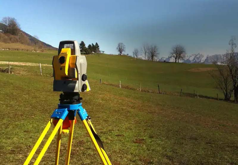
Land surveying has traditionally relied on manual methods, such as theodolites and total stations, which are still used today but have been complemented and, in some cases, replaced by more advanced technologies.
One of the most notable advancements is the use of Global Navigation Satellite Systems (GNSS), […]
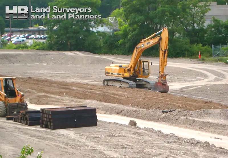
Land surveyors play a pivotal role in development projects, tackling the question of ‘What goes where and when?’
This ancient profession, extending over thousands of years, encompasses a range of activities from hydrographic surveys to high-altitude aerial mapping. Today, their expertise is integral to technologies such as GPS and mobile navigation. With the recent revival in construction, the demand for Construction Staking Services has significantly increased.”
In the realm of site development, the contributions of land surveyors are indispensable. They convert the designs of architects and engineers into tangible markers onsite, directing […]
As we look to the future, the landscape of land surveying in Maryland is poised for further transformation. Technological advancements, changing regulations, and evolving client demands are shaping the path ahead for land survey companies and surveyors.
The integration of automation and artificial intelligence (AI) is expected to streamline land surveying processes. Autonomous surveying equipment, equipped with AI algorithms, can perform tasks more efficiently and accurately than ever before. This technology will reduce the need for human intervention in repetitive surveying tasks.
Data analytics tools are becoming increasingly important for land surveyors. By analyzing large datasets collected during surveys, surveyors can extract valuable insights about land […]


